
New Orleans, September 24, 2025
New Orleans is experiencing hot and humid weather with temperatures reaching up to 93°F (34°C). The forecast includes a chance of afternoon thunderstorms that may result in flash flooding in low-lying areas. While there are currently no active flood alerts, residents and visitors are advised to stay vigilant, prepare emergency kits, and plan flexible outings in response to sudden weather changes. Street flooding has occurred recently, so knowing alternate travel routes and staying updated on weather alerts is crucial for safety.
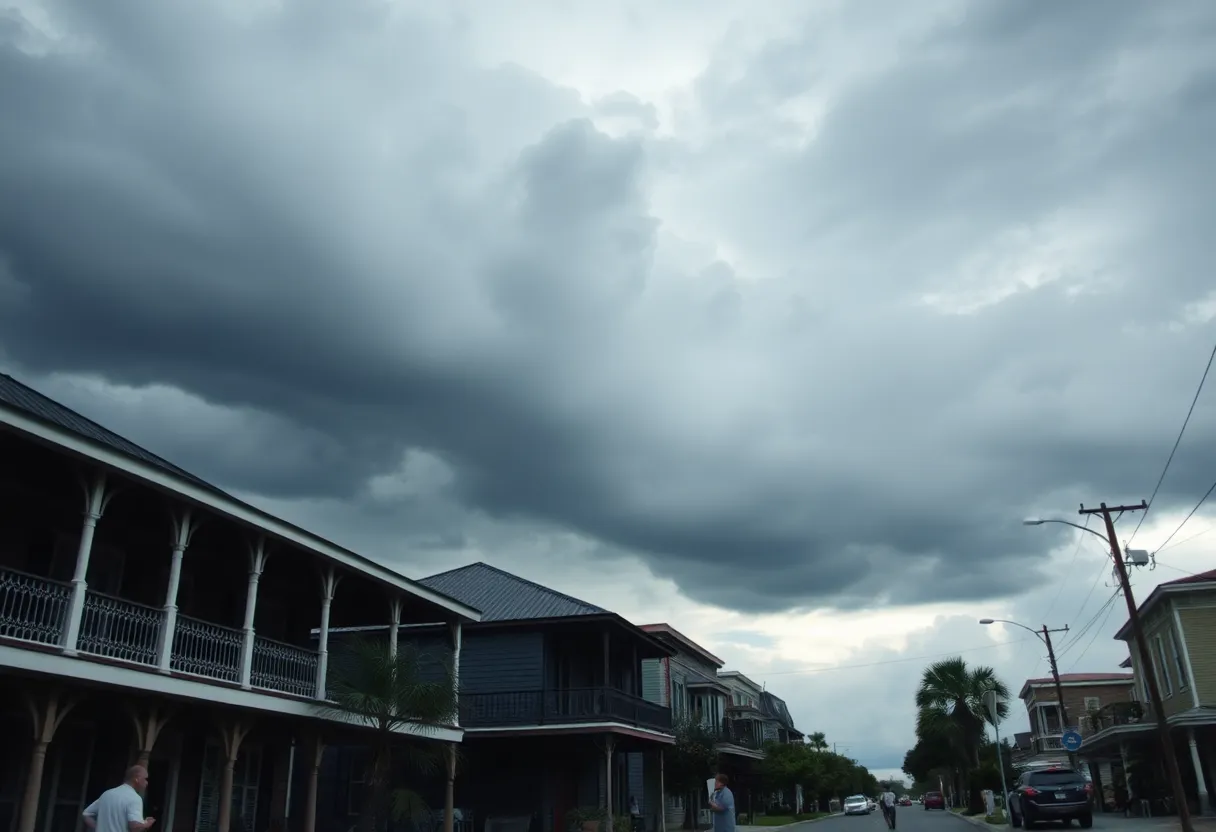
Heat, Humidity and a Chance of Afternoon Drama: What New Orleanians and Visitors Need to Know
The city is simmering today with hot, humid air — a high near 93°F (34°C) — and the forecast calls for an afternoon thunderstorm that could spark pockets of flash flooding. Right now there are no active flood alerts or road closures, but recent weeks have shown how fast things can change around here. If you live in New Orleans or you’re planning to visit, it’s time to pay attention and pack smart.
Quick snapshot
Temperatures feel heavy, the air is sticky, and a late-day thunder cell can pop up and dump a lot of rain in a short time. That combo is the usual recipe for localized flooding in low-lying neighborhoods and underpasses. Today’s setup doesn’t have any official flood warnings yet, but given how this city drains (or doesn’t), staying alert is the best move.
Recent flooding — what actually happened
Over the past year and a half, New Orleans has had a few intense episodes that should remind everyone to be cautious:
- May 9, 2025 — Flash flooding led to standing water at several underpasses and key intersections, creating hazardous driving conditions.
- May 7, 2025 — Heavy rain caused localized street flooding in major thoroughfares on the city’s west side.
- April 10, 2024 — A slow-moving storm system dumped widespread rain across the metro, triggering numerous road closures and widespread flash flooding.
Neighborhoods and trouble spots to watch
Low-lying underpasses, major intersections that act like bowls, and streets with poor drainage are the usual suspects. Some locations have turned into temporary ponds after just an hour of heavy rain — keep an eye on underpasses and older neighborhoods where pumps can get overwhelmed. When those afternoon cells fire, expect sudden trouble in spots that normally seem fine.
What locals should do
- Keep a weather app or local alert on your phone and set push alerts for severe weather.
- Know alternate routes. Main arteries can shut down fast; have a Plan B for getting home or to work.
- Keep an emergency kit in your car if you drive regularly — water, phone charger, basic first-aid, and a flashlight.
- When thunder starts, expect sudden heavy rain. Consider delaying outdoor errands until the storm passes.
What visitors should do
- Plan flexible outings in the afternoon. A parade, park visit or walking tour can be derailed by pop-up storms.
- If you’re staying in an older building or a neighborhood below street level, double-check evacuation routes and local safety info.
- Avoid dodging puddles on foot — deep water can hide hazards.
Practical flood safety tips
- Do not drive through flooded streets. Even a few inches can stall a car or sweep it away.
- Stay updated through official city emergency alerts and local advisories.
- Prepare an emergency kit with water, non-perishable food, medications, important documents in a waterproof bag, and a battery-powered radio or charged phone.
- If you encounter road closures, follow barricades and local signage — they’re there for a reason.
How to stay reliably informed
Sign up for official city emergency alerts by text, email or phone so you get timely notices about severe weather, road closures and pump outages. Also keep a trusted weather app and local traffic map handy. During heavy storms, official alerts are the fastest way to learn about sudden closures or protective actions.
If you must drive during a storm
- Slow down and turn on headlights.
- Never try to cross moving water. If the road is flooded, find another route.
- Do not park under overpasses or near low-lying curbs where water pools.
- If your vehicle stalls in water, abandon it if water rises inside; climb to higher ground safely.
FAQ
Is it safe to visit New Orleans today?
Yes, if you stay aware of the weather and avoid venturing out during the afternoon thunderstorm risk. No active flood alerts are in place right now, but conditions can change quickly.
Which areas are most at risk during short, heavy storms?
Underpasses, low-lying streets and intersections that collect runoff are the first places to flood. Older drainage zones and streets with limited pump access can fill fast.
What should I pack if I’m visiting and there’s a flood risk?
Pack a small emergency kit: bottled water, snacks, essential meds, waterproof pouch for documents, a portable phone charger and a lightweight rain jacket or poncho.
How do I know if roads are closed?
Check official city alerts and local traffic maps. If you encounter barricades or police directing traffic, follow their guidance — do not try to drive around closures.
Can I drive through standing water if it looks shallow?
No. Water depth is deceptive and currents can be stronger than they look. Even a few inches can cause loss of control or stall your vehicle.
At-a-glance chart: Today’s key points
| Feature | Current Status / Advice |
|---|---|
| Temperature | 93°F (34°C) — hot and humid |
| Thunderstorm Risk | Afternoon cells likely — brief, heavy downpours possible |
| Flood Alerts | No active flood alerts at the moment; monitor updates |
| Recent Flash Flood Dates | May 7, 2025; May 9, 2025; widespread event April 10, 2024 |
| Common Trouble Spots | Underpasses, low intersections, older drainage zones |
| Recommended Action | Sign up for official alerts, avoid flooded streets, have an emergency kit |
Bottom line: this city handles weather theatrics all the time, but that doesn’t mean we should get casual about it. Stay informed, plan for sudden storms, and if water’s on the road, turn around and find another route. Keep your cool, keep your phone charged, and keep an eye on the sky — that’s how New Orleanians stay one step ahead.
Deeper Dive: News & Info About This Topic
HERE Resources
Billy Dietrich Biography: Early Life, Career, And Notable Works
New Orleans Commemorates 20 Years Since Hurricane Katrina
Preserving the Art of Blacksmithing in New Orleans
Best of New Orleans Issue Celebrated Amid Rising Concerns
Rising Sea Levels Uncover Thousands of Abandoned Oil Wells in Louisiana
Moving to New Orleans Guide: Find Apartments, Schools & Local Tips
Holiday Events Near Me Today New Orleans: Last-Minute Parades, Markets & Light Displays
Tropical Wave off Africa Shows Low Development Potential
Mardi Gras 2025 Attracts Record Crowds to New Orleans
Potential Development of Tropical Wave Off Africa’s Coast
Author: STAFF HERE NEWORLEANS WRITER
The NEW ORLEANS STAFF WRITER represents the experienced team at HERENewOrleans.com, your go-to source for actionable local news and information in New Orleans, Orleans Parish, and beyond. Specializing in "news you can use," we cover essential topics like product reviews for personal and business needs, local business directories, politics, real estate trends, neighborhood insights, and state news affecting the area—with deep expertise drawn from years of dedicated reporting and strong community input, including local press releases and business updates. We deliver top reporting on high-value events such as French Quarter Festival, New Orleans Jazz & Heritage Festival, and Essence Music Festival. Our coverage extends to key organizations like the New Orleans Chamber of Commerce and Greater New Orleans, Inc., plus leading businesses in energy, healthcare, and education that power the local economy such as Entergy, Ochsner Health, and Tulane University. As part of the broader HERE network, including HEREShreveport.com, we provide comprehensive, credible insights into Louisiana's dynamic landscape.