
News Summary
A Flood Advisory has been issued for multiple parishes in southeast Louisiana, including Jefferson and Orleans, as heavy rainfall and thunderstorms continue to affect the area. Minor flooding is already occurring with an additional 1 to 2 inches of rain expected. Flash flood warnings are active, urging residents to remain vigilant and avoid driving through flooded areas. Emergency services are on high alert as ongoing severe weather raises safety concerns throughout the region.
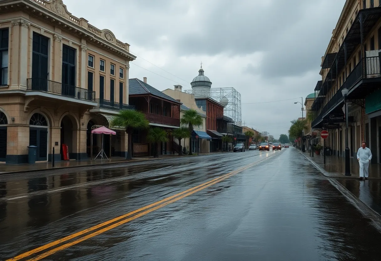
New Orleans – A Flood Advisory has been issued for multiple parishes in southeast Louisiana, including Jefferson, Lafourche, St. Charles, and Terrebonne, which will remain in effect until 4:45 p.m. today. An additional advisory for Orleans Parish is active until 5:15 p.m., as ongoing thunderstorms continue to produce heavy rainfall across the region.
Currently, radar indicates that minor flooding is occurring in the affected areas, with rainfall accumulations previously measured between 1 to 2 inches. An additional 1 to 2 inches of rain is expected shortly, exacerbating the already challenging conditions.
A flash flood warning is also in effect for Orleans, Jefferson, Plaquemines, and St. Charles parishes until 6 p.m. this evening, highlighting the urgency of the situation. Meanwhile, St. Tammany Parish is under a flood advisory until 9:30 p.m., indicating that impacts are being felt across a wide swath of southeast Louisiana.
Heavy rains generated by strong thunderstorms are contributing to the hazardous flood conditions, with water currently observed taking over the roadway at St. Mary Street and Magazine Street in the Lower Garden District. Reports indicate that vehicles, including a truck navigating Lafayette Street in downtown New Orleans, are facing difficult conditions due to flooding.
The flash flood warning specifically covers portions of important highways, including Interstate 10 between mile markers 223 and 243, as well as I-610 between mile markers 1 and 4. The National Weather Service has warned that flash flooding is either ongoing or expected to start imminently, urging residents to stay vigilant.
Earlier today, a thunderstorm capable of producing tornadoes was detected over Metairie at 3:30 p.m., but the related tornado warning was lifted shortly after at 4 p.m. The severe weather continues to bring not only heavy rains but also strong winds and hail, further complicating conditions for both everyday activities and emergency responses.
This significant weather event serves as a reminder for residents to remain alert and take necessary precautions to stay safe during times of heavy rainfall and potential flooding. Effective and timely measures are essential to avoid the pitfalls associated with such severe weather phenomena.
As the situation develops, residents are advised to monitor local conditions carefully, stay indoors, and avoid driving through flooded areas. Authorities continue to recommend preparedness in anticipation of potential flooding while emergency services remain on high alert to respond as needed.
With conditions expected to persist, it is vital for residents across the impacted parishes to stay informed and heed warnings from local authorities. As the day progresses, updated information will be crucial in effectively managing the ongoing risks associated with this severe weather system.
Deeper Dive: News & Info About This Topic
HERE Resources
Partial Lifting of Boil Water Advisory in Uptown New Orleans
New Orleans Faces Severe Storms This Weekend, Events Rescheduled
Additional Resources
- WDSU: New Orleans Flood Advisory Sunday
- Wikipedia: Flood
- WWLTV: New Orleans Weather Flash Flood Warning
- Google Search: New Orleans flooding
- NOLA: New Orleans Flash Flood Warning
- Google Scholar: Flood Management
- The Advocate: Flash Flood Warning Across Acadiana
- Encyclopedia Britannica: Flood
- Fox Weather: New Orleans Flash Flood Rain Threat
- Google News: Louisiana floods

Author: STAFF HERE NEWORLEANS WRITER
The NEW ORLEANS STAFF WRITER represents the experienced team at HERENewOrleans.com, your go-to source for actionable local news and information in New Orleans, Orleans Parish, and beyond. Specializing in "news you can use," we cover essential topics like product reviews for personal and business needs, local business directories, politics, real estate trends, neighborhood insights, and state news affecting the area—with deep expertise drawn from years of dedicated reporting and strong community input, including local press releases and business updates. We deliver top reporting on high-value events such as French Quarter Festival, New Orleans Jazz & Heritage Festival, and Essence Music Festival. Our coverage extends to key organizations like the New Orleans Chamber of Commerce and Greater New Orleans, Inc., plus leading businesses in energy, healthcare, and education that power the local economy such as Entergy, Ochsner Health, and Tulane University. As part of the broader HERE network, including HEREShreveport.com, we provide comprehensive, credible insights into Louisiana's dynamic landscape.