
News Summary
New Orleans is gearing up for potential flooding as Tropical Depression ‘Invest 93L’ approaches the Gulf. Heavy rainfall is expected, with forecasts predicting 2 to 8 inches across southern Louisiana. Sandbag stations are set to open to aid residents in preparation. Flood watches are effective for southeast Louisiana, and local authorities emphasize community readiness to safeguard against severe weather impacts.
New Orleans is preparing for potential flooding as a Tropical Depression, known as “Invest 93L,” approaches the Gulf. The National Hurricane Center is currently monitoring the disturbance as it moves westward near the northern Gulf Coast, leading to significant concerns regarding heavy rainfall and flooding in the region.
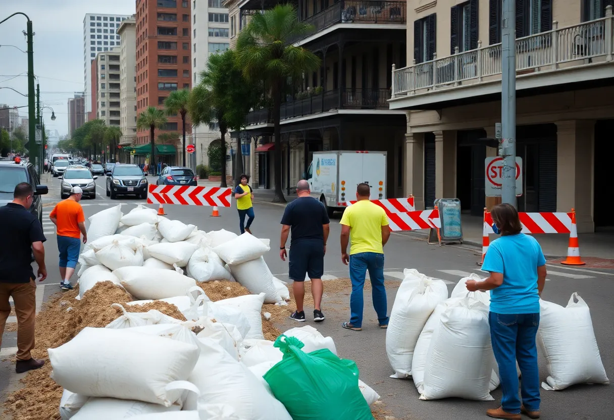
Sandbag stations are being opened across various New Orleans-area parishes starting on July 16 at 10:30 a.m. Residents are encouraged to fill and load their own sandbags, with a limit of 12 sandbags per household. This precautionary measure comes as flood watches remain in effect for all of southeast Louisiana, including New Orleans, through Saturday morning.
Forecasts indicate that southern Louisiana could experience rainfall between 2 to 5 inches, while areas in Acadiana may receive up to 8 inches. Parts of southeast Louisiana have already been issued flood advisories, including Baton Rouge, where rainfall amounts have varied from 2 to 8 inches over recent days. The heaviest rain is anticipated to fall along and south of the Interstate 10 corridor, impacting southern Louisiana, southern Mississippi, and eastern Texas. There is a growing concern that rainfall rates could exceed 3 inches per hour during some storms, raising flash flood risks.
The Sewerage & Water Board of New Orleans has indicated that 86 of 93 major pumps in the city are operational, and all three power turbines are prepared for use. This readiness is essential to managing potential flooding as residents have begun lining up for sandbags in neighborhoods such as Gentilly and Algiers. In anticipation of the heavy rains, the state has lifted parking restrictions on neutral grounds.
Officials have emphasized that slow-moving storms could lead to prolonged periods of heavy rain accumulation, heightening the risk of flooding. Weather forecasts suggest that even though there is still a chance for the disturbance to strengthen into a tropical depression, the likelihood of this happening is decreasing. If a tropical storm does develop, it would be named Dexter, marking the fourth named storm of the 2025 Atlantic hurricane season. Meteorologists have noted a decrease in the organization of the disturbance after it passed over Florida.
This preparation by local authorities and the community reflects a proactive approach to mitigating potential hazards posed by severe weather. As the situation unfolds, residents are advised to stay informed and take necessary precautions to ensure their safety.
Deeper Dive: News & Info About This Topic
HERE Resources
New Orleans Braces for Political Transformations Ahead of Elections
New Orleans Prepares for Heavy Rain and Flooding
Tropical Rainstorm to Impact New Orleans with Heavy Flooding
New Orleans Prepares for Tropical Storm and Flooding Risks
New Orleans Prepares for Heavy Rainfall and Flooding Threat
New Orleans Prepares for Heavy Rainfall as Tropical Disturbance Approaches
Jean Lafitte Prepares for Mayoral Election Amid Changes
Louisiana Prepares for Severe Weather as Storm Approaches
New Orleans Prepares for Heavy Rainfall from Tropical System
Flood Watch Issued for Southeast Louisiana
Additional Resources
- ABC News: Tropical Rainstorm Drench Gulf Coast
- Wikipedia: Tropical Depression
- Weather.com: Invest 93L Flood Threat
- Google Search: Tropical Depression Invest 93L
- NOLA.com: Storm Forecast Louisiana
- Encyclopedia Britannica: Tropical Storm
- ABC News: Tropical Rains Inundate Louisiana
- Google News: Tropical Rains Inundate Louisiana


